The PHIVOLCS FaultFinder
Joel Bandibas
-
Updated
2025-11-07
-
Current Version
18
-
Offered By

Description
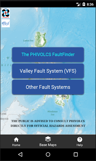
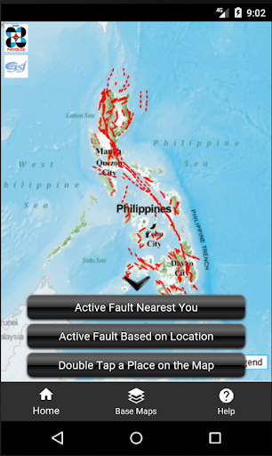
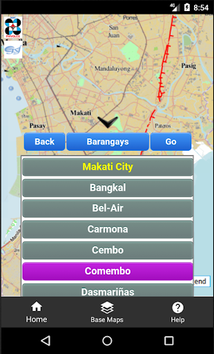
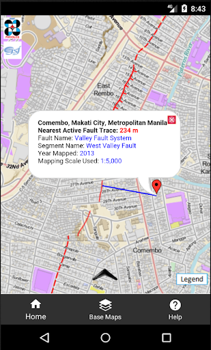
The PHIVOLCS FaultFinder mobile app shows information about the distance between the user's current location, address or selected location on the map and the nearest active fault. This app needs internet connection to access the web-based active fault database of PHIVOLCS and the necessary web services. The database provides the backend source of information for the Web Map Service (WMS) and Web Processing Service (WPS) used for displaying the active fault map and querying fault trace locations, respectively. This app uses three base maps, the Philippine Geoportal Map, Google Maps and the OpenStreetMap, which are served as web services provided by the data owners. The Philippine Geoportal Map is provided by the National Mapping and Resource Information Authority (NAMRIA) of the Philippines. This app is a classic Web-based Geographic Information System (WebGIS) following the Spatial Data Infrastructure model. The FaultFinder app is the product of the joint collaboration between the Philippine Institute of Volcanology and Seismology (PHIVOLCS), Department of Science and Technolog (DOST), Philippines and Geological Survey of Japan (GSJ), National Institute of Advanced Industrial Science and Technology (AIST), Japan. Dr. Renato Solidum, director of PHIVOLCS, initiated the idea of developing the app. The FaultFinder app was developed by Dr. Joel C. Bandibas of GSJ with the cooperation of the research and development personnel of PHIVOLCS.
Show more
OTHERS:MAP_AND_NAVIGATION
What\'s New in Version 1.3.5
Last updated on Nov 07,2025
Minor bug fixes and improvements. Install or update to the newest version to check it out!
Show less
Screen shots
Information
-
Updated2025-11-07
-
Current Version18
-
Offered By

-
Apk size0MB
-
Requires AndroidAndroid 4.4+