InfoBencanaJKM
Jabatan Kebajikan Masyarakat
-
Dikemas kini
2025-01-13
-
Versi Semasa
4.12.20
-
Ditawarkan Oleh

Penerangan
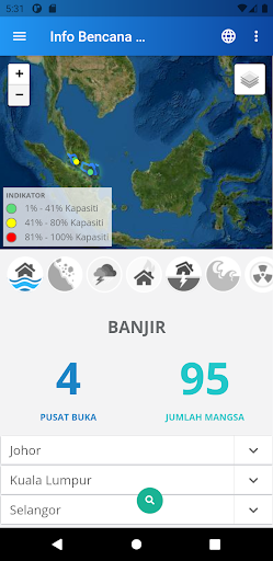
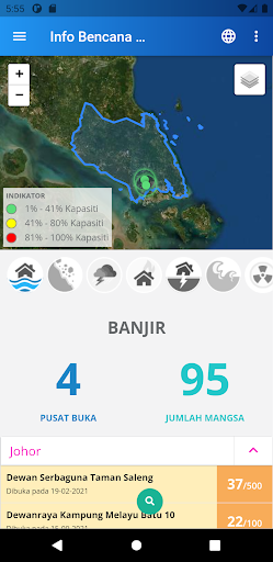
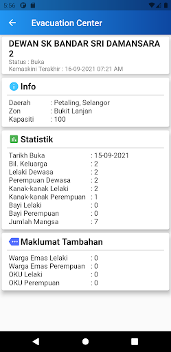
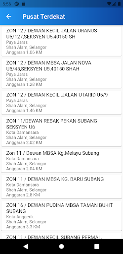
Get information such as the Disaster Relief Centres;
- Evacuation Centre and Flood Level nearby in every area.
- Road closed due to flooding
- Updated the water level of the river
- Capacity and capacity during a season in any evacuation centers.
- Distance transfer center nearest you!
- Maps and directions to the nearest evacuation center.
- Statistics Victims
- Map Helipad
- Help Flood Victims
- Storage Facility
Tunjukkan Lagi
OTHERS:WEATHER
Apa yang Baru dalam Versi 1.3.5
Kemaskini terakhir pada Jan 13,2025
Pembaikan pepijat kecil dan penambahbaikan. Pasang atau kemas kini ke versi terbaru untuk mencubanya!
Kurangkan
tangkapan skrin
Maklumat
-
Dikemas kini2025-01-13
-
Versi Semasa4.12.20
-
Ditawarkan Oleh

-
saiz pekej aplikasi0MB
-
Memerlukan AndroidAndroid 4.4+